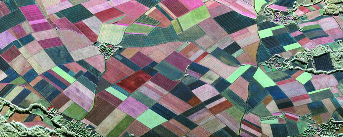
Agricultural Applications with SAR
Agricultural Applications with SAR
Across the globe approximately one in every seven people go hungry every day. About 1/3rd of the agricultural produce is lost or wasted each year. As per the presently rising food demand agricultural yield needs to increase by 60% over the next 40 years to meet the projected demand. Agricultural land occupies approximately 38% of the available ice-free terrestrial land surface, which includes about 12% of croplands and 26% of pastures. Off the total available agricultural production human consumption amounts to 62% of the produce followed by animal feed amounting to 35% and mere 3% for bioenergy and other industrial production. Unfavourable growing conditions can change the productivity of an agricultural field within a short span. Therefore, timeliness is the key to monitor such an adverse change that can impact the yield.
With the advent of airborne & spaceborne remote sensing platforms, Earth observation has been transformed into a unique and cost-efficient tool to acquire timely and spatially consistent information over large areas with a high revisit frequency. Due to frequent measurement requirement during the short dynamic growing season of crops, a sensor platform with all-weather & active imaging capabilities was desired. Synthetic aperture radar systems aptly address such requirements due to their independence of imaging under day-night conditions by virtue of their inbuilt active power source. These sensors supersedes or rather complements the optical sensors due to the sensitivity of their imaging signals towards dielectric (water content & biomass) and geometrical properties (plant & canopy structure and surface roughness) properties of the crops. Remote sensing in the agricultural scenario can be looked at majorly as a tool for management and optimization of resources for authorities or government agencies at national-regional-local scale and for farmers with extensive fields. Both of these users can utilize this tool from their respective point of view as show below,
Demand Objectives
Crop-type identification Insurance litigations & subsidies on the plantation of cash crops
Water stress monitoring Forecasting & allocation of water resources
Yield forecasting Budget planning & commodity market prediction
Crop growth stage monitoring Implementing farming practices like the application of fungicides, harvesting etc.
Crop health monitoring Irrigation decision
Among several remote sensing applications listed by the government bodies across the world, crop type identification, land cover utilization, and yield estimation are the some of the foremost and preferred applications. Unlike optical sensors where the return is quantified by the radiance of the land cover, SAR images are quantified by the backscatter from the crops. Several imaging and crop factors dictates the backscattering mechanism from the crop fields. The interactions is dictated by imaging parameters like wavelength that determines the penetration of the incoming signal beneath the top canopy layer, which eventually determines the backscattering mechanism. The backscattered signal can belong all the way from the underlying ground (Surface scattering), to soil-crop stem interaction (Double bounce scattering), to the leaves, stem, and grain pods of the crops (Volume scattering). Since both the dielectric & geometrical properties varies as a function of crop type and their phonological stages, this characteristic is therefore exploited in identification and classification of different crop species growing over the field. Determination of imaging parameters like wavelength and polarization of a crop contributes towards its identification. At longer wavelengths a particular crop can be perceived as comparatively smoother target due to the diminishing dimensions of the crop elements. Therefore, higher frequencies (e.g. X-band) are dominated by canopy scattering while lower frequencies (e.g. L- or P-band) are influenced by backscatter from soil surface with less information on crop type. Similarly due to vertical orientation of the crops VV (cases where both emitted and received signal has vertical polarization) channel undergoes significant attenuation as compared to HH channel, which demonstrates more sensitivity towards information about underlying soil like its roughness & moisture. The imaging angle of incidence is also a crucial factor pre-determined by the outcome expected out of the application. While a shallow incidence angle (greater than 40o) measurement is ideal for determining the crop conditions due to its greater signal path length through the vegetation, the steep incidence angles (less than 30o) are better suited for soil moisture applications. A reliable crop identification algorithm, therefore, considers the dynamics of imaging w.r.t. both crop structure & imaging sensor configuration.